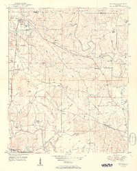
1950 Map of Nauvoo
USGS Topo · Published 1950About this map
Nauvoo serves as a primary hub in this northern Walker County landscape, situated where the Southern railroad line follows the winding course of Little Blackwater Creek. The area is defined by a dense network of country churches and rural schools, including Brookside Ch, Wilson Chapel, and the Nix Sch, reflecting the established community fabric of the late 1940s. Heavy industrial activity is evident through several Strip Mine operations scattered west of Nauvoo, highlighting the region's reliance on coal extraction.
Find a feature on this map
61 named features on this map. Tap any name to fly to it.
Don’t see what you’re looking for? This feature index may not catch every label — zoom into the map to look around manually.
Map Details
Editions of this 1950 Nauvoo Map
2 editions found
Other maps of this area

1893 · Jasper
USGS Topo · 1:125,000

1949 · Townley
USGS Topo · 1:24,000

1949 · Jasper
USGS Topo · 1:24,000

1949 · Manchester
USGS Topo · 1:24,000

1949 · Nauvoo
USGS Topo · 1:24,000

1950 · Nauvoo
USGS Topo · 1:24,000

1950 · Manchester
USGS Topo · 1:24,000

1951 · Jasper
USGS Topo · 1:24,000

1951 · Townley
USGS Topo · 1:24,000

1953 · Birmingham
USGS Topo · 1:250,000