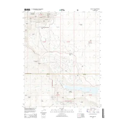
2014 Map of Navajo Lake
USGS Topo · Published 2014About this map
Cedar Breaks National Monument dominates the northwestern corner of this study, revealing a complex landscape of geological features like the Cedar Breaks Amphitheater, The Bartizan, and Point Supreme. The map captures the high-altitude terrain of the Markagunt Plateau, where the border between Iron Co and Kane Co bisects the region. Central to the southern half is Navajo Lake, a significant water body situated near the Navajo Lake Lodge. The area is characterized by numerous natural springs such as Olsen Spring and Boy Scout Spring, which feed into the local hydrology alongside Cascade Falls. This survey illustrates the intricate network of forest roads like Navajo Lake RD and State Rte 148 that provide access to the Dixie National Forest and landmarks like Andy Nelson Peak.
Find a feature on this map
68 named features on this map. Tap any name to fly to it.
Don’t see what you’re looking for? This feature index may not catch every label — zoom into the map to look around manually.
Map Details
Editions of this 2014 Navajo Lake Map
This is the sole edition of this map. No revisions or reprints were ever made.
Other maps of this area

1886 · Kanab
USGS Topo · 1:250,000

1953 · Cedar City
USGS Topo · 1:250,000

1954 · Orderville Canyon NW
USGS Topo · 1:24,000

1957 · Orderville Canyon NE
USGS Topo · 1:24,000

1958 · Cedar City
USGS Topo · 1:250,000

1958 · Orderville
USGS Topo · 1:62,500

1958 · Cedar Breaks
USGS Topo · 1:62,500

1958 · Panguitch Lake
USGS Topo · 1:62,500

1962 · Cedar City
USGS Topo · 1:250,000
1980 · Straight Canyon
USGS Topo · 1:24,000