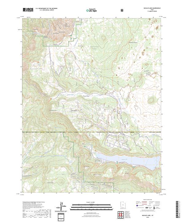
2023 Map of Navajo Lake
USGS Topo · Published 2023About this map
Cedar Breaks National Monument dominates the northern portion of this landscape, where the Pink Cliffs and dramatic overlooks like Point Supreme and Spectra Point define the high-altitude geography. The southern reaches are characterized by the seasonal waters of Navajo Lake and the volcanic features of The Craters and the Lava Desert. This high-country region on the Markagunt Plateau is a complex network of recreational trails and forest roads, including the Virgin River Rim Trl and the Navajo Lake Snowmobile Trl. The transition from the Ashdown Gorge Wilderness in the west to the dense woodlands of Dixie National Forest illustrates the varied ecological zones of southwestern Utah, while points such as Andy Nelson Peak and Gooseberry Point offer significant landmarks for backcountry navigation.
Find a feature on this map
74 named features on this map. Tap any name to fly to it.
Don’t see what you’re looking for? This feature index may not catch every label — zoom into the map to look around manually.
Map Details
Editions of this 2023 Navajo Lake Map
This is the sole edition of this map. No revisions or reprints were ever made.
Other maps of this area

1886 · Kanab
USGS Topo · 1:250,000

1953 · Cedar City
USGS Topo · 1:250,000

1954 · Orderville Canyon NW
USGS Topo · 1:24,000

1957 · Orderville Canyon NE
USGS Topo · 1:24,000

1958 · Cedar City
USGS Topo · 1:250,000

1958 · Orderville
USGS Topo · 1:62,500

1958 · Cedar Breaks
USGS Topo · 1:62,500

1958 · Panguitch Lake
USGS Topo · 1:62,500

1962 · Cedar City
USGS Topo · 1:250,000
1980 · Straight Canyon
USGS Topo · 1:24,000