
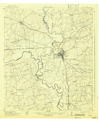
1914 Map of Navasota
USGS Topo · Published 1914About this map
Navasota serves as the industrial and rail hub of this 1914 Texas landscape, where the Navasota River and Brazos River converge. The intricate network of the Houston and Texas Central RR and several other lines dictate the settlement patterns of the era, connecting agricultural outposts like Allen Farm, Steele Farm, and Wilsons Gin to the larger markets. Beyond the tracks, the rural social fabric is visible through a high density of country schools including Mt Zion School, Coles Creek School, and Grange Hall School. Local landmarks like Hidalgo Falls and the village of Washington sit along the riverbanks, marking historical crossing points and natural obstacles. The map captures a moment when land ownership and local education were deeply localized, evidenced by the numerous family-named farms and small community centers like Graball and Courtney scattered across the river bottoms.
Find a feature on this map
63 named features on this map. Tap any name to fly to it.
Don’t see what you’re looking for? This feature index may not catch every label — zoom into the map to look around manually.
Map Details
Editions of this 1914 Navasota Map
2 editions found
Other maps of this area

1913 · Millican
USGS Topo · 1:31,680

1914 · Gay Hill
USGS Topo · 1:62,500

1930 · Brenham
USGS Topo · 1:62,500

1954 · Beaumont
USGS Topo · 1:250,000

1954 · Austin
USGS Topo · 1:250,000

1956 · Bryan
USGS Topo · 1:62,500

1956 · Hempstead
USGS Topo · 1:62,500

1956 · Brenham
USGS Topo · 1:62,500

1956 · Carlos
USGS Topo · 1:62,500

1957 · Beaumont
USGS Topo · 1:250,000