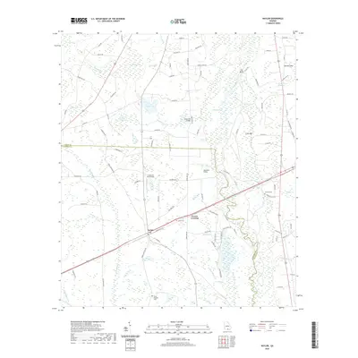
2020 Map of Naylor
USGS Topo · Published 2020About this map
The settlement of Naylor and the nearby Greens Crossing anchor this portion of the Georgia coastal plain along the boundary between Lowndes and Lanier counties. The landscape is defined by its complex hydrography, characterized by numerous bays and branches including George Carter Island Bay, Fish Pond Bay, and the slow-moving Alapaha River. This river corridor features notable crossings such as Dixon Mill Bridge and Hotchkiss Bridge, reflecting a rural infrastructure built around the local waterways and mills. Local history and genealogy are preserved in the locations of James Cem, Foreman Cem, and Sweet Prospect Cem, while the unconventional Christians Folly Airport stands out as a unique private landmark. Small ponds and branches like Monk Pond and Meetinghouse Br illustrate the dense network of wetlands that historically shaped the region's agricultural and transit patterns.
Find a feature on this map
99 named features on this map. Tap any name to fly to it.
Don’t see what you’re looking for? This feature index may not catch every label — zoom into the map to look around manually.
Map Details
Editions of this 2020 Naylor Map
This is the sole edition of this map. No revisions or reprints were ever made.
Other maps of this area

1953 · Waycross
USGS Topo · 1:250,000

1954 · Valdosta
USGS Topo · 1:250,000

1958 · Valdosta
USGS Topo · 1:250,000

1958 · Waycross
USGS Topo · 1:250,000

1959 · Valdosta
USGS Topo · 1:250,000

1968 · Naylor
USGS Topo · 1:24,000

1968 · Lakeland
USGS Topo · 1:24,000

1971 · Indianola
USGS Topo · 1:24,000

1971 · Howell
USGS Topo · 1:24,000

1971 · Stockton
USGS Topo · 1:24,000