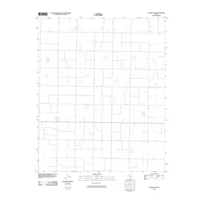
2010 Map of Nazareth SW
USGS Topo · Published 2010About this map
Agricultural patterns and a strict rectangular road network define this landscape in the Texas Panhandle. The terrain is dotted with Numerous ephemeral playa lakes, typical of the Llano Estacado, which provide vital drainage across the plains. These natural basins are interspersed between irrigated fields and ranch lands, where the orderly grid of county roads facilitates local travel and transport. Central to the area is Fm 1567, a primary north-south artery connecting the rural sections between Co Rd 610 and Co Rd 617. The map illustrates a high-plains environment where land use is dictated by access to water and the precise surveying of the grid, including routes like Co Rd 520 and Co Rd 522. For researchers, this document provides a clear look at the spatial organization of Castro County at the beginning of the 21st century.
Find a feature on this map
15 named features on this map. Tap any name to fly to it.
Don’t see what you’re looking for? This feature index may not catch every label — zoom into the map to look around manually.
Map Details
Editions of this 2010 Nazareth SW Map
This is the sole edition of this map. No revisions or reprints were ever made.
Other maps of this area

1954 · Clovis
USGS Topo · 1:250,000

1958 · Clovis
USGS Topo · 1:250,000

1962 · Dodd NE
USGS Topo · 1:24,000

1963 · Hart NW
USGS Topo · 1:24,000

1965 · Dimmitt
USGS Topo · 1:24,000

1965 · Hart
USGS Topo · 1:24,000

1965 · Nazareth SW
USGS Topo · 1:24,000

1965 · Nazareth
USGS Topo · 1:24,000

1966 · Jumbo
USGS Topo · 1:24,000

1966 · Nazareth NW
USGS Topo · 1:24,000