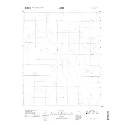
2019 Map of Nazareth SW
USGS Topo · Published 2019About this map
Agricultural patterns and ephemeral hydrology define the landscape of this Castro County region. The survey reveals a high-plains terrain marked by numerous depressions and wetlands typical of the Llano Estacado. A systematic grid of local infrastructure, including Co Rd 518, Co Rd 520, and Co Rd 522, segments the land into large-scale farming and ranching parcels. The primary north-south artery, Fm 2567, provides the central link through this sparsely populated territory. This detailed mapping by the U.S. Geological Survey underscores the importance of county-maintained roads like Co Rd 610 and Co Rd 614 in sustaining the rural economy of the Texas Panhandle during the early twenty-first century.
Find a feature on this map
15 named features on this map. Tap any name to fly to it.
Don’t see what you’re looking for? This feature index may not catch every label — zoom into the map to look around manually.
Map Details
Editions of this 2019 Nazareth SW Map
This is the sole edition of this map. No revisions or reprints were ever made.
Other maps of this area

1954 · Clovis
USGS Topo · 1:250,000

1958 · Clovis
USGS Topo · 1:250,000

1962 · Dodd NE
USGS Topo · 1:24,000

1963 · Hart NW
USGS Topo · 1:24,000

1965 · Dimmitt
USGS Topo · 1:24,000

1965 · Hart
USGS Topo · 1:24,000

1965 · Nazareth SW
USGS Topo · 1:24,000

1965 · Nazareth
USGS Topo · 1:24,000

1966 · Jumbo
USGS Topo · 1:24,000

1966 · Nazareth NW
USGS Topo · 1:24,000