
1955 Map of Nebraska City
USGS Topo · Published 1967About this map
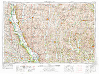
The Missouri River defines the western edge of this mid-century landscape, where the borders of Nebraska, Iowa, Missouri, and Kansas converge. The terrain is characterized by a dense network of rural infrastructure, including a significant number of country schools such as Common Sense School, Lonesome School, and the Rock Bluff School. These educational sites, along with churches like St Oswald Church and Mt Pleasant Church, provide a clear view of the dispersed agricultural settlement patterns that persisted into the 1950s.
Find a feature on this map
246 named features on this map. Tap any name to fly to it.
Don’t see what you’re looking for? This feature index may not catch every label — zoom into the map to look around manually.
Map Details
Editions of this 1955 Nebraska City Map
3 editions found
Other maps of this area

1885 · Atchison
USGS Topo · 1:125,000

1888 · Atchison
USGS Topo · 1:125,000

1888 · Hiawatha
USGS Topo · 1:125,000

1889 · Seneca
USGS Topo · 1:125,000

1893 · Atchison
USGS Topo · 1:125,000

1893 · Fremont
USGS Topo · 1:125,000

1894 · Seneca
USGS Topo · 1:125,000

1894 · Hiawatha
USGS Topo · 1:125,000

1896 · Fremont
USGS Topo · 1:125,000

1903 · Weeping Water
USGS Topo · 1:125,000