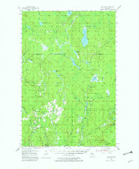
1955 Map of Ned Lake
USGS Topo · Published 1982About this map
Copper Country State Forest dominates this mid-century landscape in the Upper Peninsula, showing a region defined by its timber and mineral potential. The intricate waterways of the Net River and its various branches, including the West Branch and East Branch, create a dense network of drainage flowing toward the Ned Lake area. This 1955 survey captures the industrial remnants and aviation growth of the era, from the established Milwaukee St Paul and Pacific Railroad line to the remote Amasa Landing Field. Local agricultural and residential markers like Triangle Ranch and the small settlement of Old Joe suggest the sparse but persistent human footprint in this wilderness. The presence of an Old Railroad Grade and the Premo Dam point to a legacy of logging and water management that shaped the topography of Hematite and Crystal Falls.
Find a feature on this map
61 named features on this map. Tap any name to fly to it.
Don’t see what you’re looking for? This feature index may not catch every label — zoom into the map to look around manually.
Map Details
Editions of this 1955 Ned Lake Map

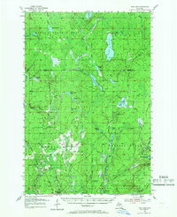
Other maps of this area

1895 · Ned Lake
USGS Topo · 1:62,500

1895 · Perch Lake
USGS Topo · 1:62,500

1898 · Iron River
USGS Topo · 1:62,500

1899 · Sagola
USGS Topo · 1:62,500

1899 · Witbeck
USGS Topo · 1:62,500

1899 · Crystal Falls
USGS Topo · 1:62,500

1945 · Sunset Lake
USGS Topo · 1:24,000

1945 · Kelso Junction
USGS Topo · 1:24,000

1945 · Amasa
USGS Topo · 1:24,000

1946 · Sunset Lake
USGS Topo · 1:31,680
Featured Places
- Hematite Township, MI
- Covington Township, MI
- Crystal Falls Township, MI
- Spurr Township, MI
- Iron County, MI