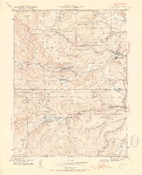
1942 Map of Nederland
USGS Topo · Published 1954About this map
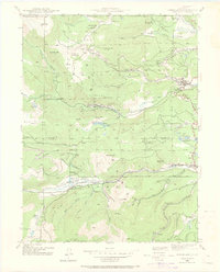
The town of Nederland serves as a hub for this high-altitude landscape within the Roosevelt National Forest, where the transition from mining to early water management is clearly visible. Surveyed during the early 1940s, the map documents a region heavily influenced by extraction and the expansion of the Denver Salt Lake railroad. Hard-rock mining legacy is evident through the Bluebird Mine, Conger Mine, and Illinois Mine, while timber operations are marked by the Zarlengo Saw Mill near Park Lake. The presence of the Barker Reservoir and Lakewood Reservoir indicates the growing importance of the area for water storage serving the Front Range. Smaller settlements like Caribou, Eldora, and Rollinsville are connected by roads and rail through steep terrain, including the narrow corridor of South Boulder Creek.
Find a feature on this map
73 named features on this map. Tap any name to fly to it.
Don’t see what you’re looking for? This feature index may not catch every label — zoom into the map to look around manually.
Map Details
Editions of this 1942 Nederland Map
6 editions found
Other maps of this area

1899 · West Denver
USGS Topo · 1:125,000

1902 · Boulder
USGS Topo · 1:62,500

1904 · Boulder
USGS Topo · 1:62,500

1905 · Central City
USGS Topo · 1:62,500

1906 · Blackhawk
USGS Topo · 1:62,500

1910 · Central City
USGS Topo · 1:62,500

1912 · Central City
USGS Topo · 1:62,500

1915 · Longs Peak
USGS Topo · 1:125,000

1919 · Rocky Mountain National Park
USGS Topo · 1:125,000

1942 · Nederland
USGS Topo · 1:24,000
Featured Places
- Nederland, CO
- Caribou City, CO
- Rollinsville, CO
- East Portal Distributed Camping Area, CO
- West Magnolia Campground, CO