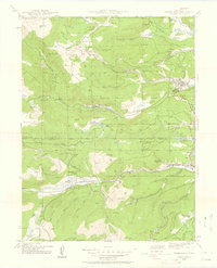
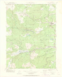
1942 Map of Nederland
USGS Topo · Published 1959About this map
Nederland serves as a central hub in this high-altitude landscape, where the waters of Middle Boulder Creek flow into the Barker Reservoir. Surveyed during the early 1940s, the map reveals an intricate network of mining operations and small mountain settlements connected by rugged terrain. To the northwest, the historic mining district of Caribou sits near Caribou Hill, surrounded by a concentration of industrial sites including the Illinois Mine, Conger Mine, and Pandora Mine.
Find a feature on this map
83 named features on this map. Tap any name to fly to it.
Don’t see what you’re looking for? This feature index may not catch every label — zoom into the map to look around manually.
Map Details
Editions of this 1942 Nederland Map
6 editions found
Other maps of this area

1899 · West Denver
USGS Topo · 1:125,000

1902 · Boulder
USGS Topo · 1:62,500

1904 · Boulder
USGS Topo · 1:62,500

1905 · Central City
USGS Topo · 1:62,500

1906 · Blackhawk
USGS Topo · 1:62,500

1910 · Central City
USGS Topo · 1:62,500

1912 · Central City
USGS Topo · 1:62,500

1915 · Longs Peak
USGS Topo · 1:125,000

1919 · Rocky Mountain National Park
USGS Topo · 1:125,000

1942 · Nederland
USGS Topo · 1:24,000
Featured Places
- Nederland, CO
- Caribou City, CO
- Rollinsville, CO
- East Portal Distributed Camping Area, CO
- West Magnolia Campground, CO