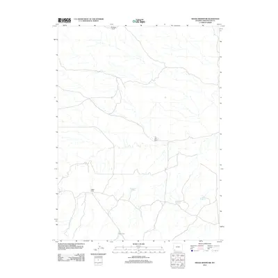
2012 Map of Needle Reservoir
USGS Topo · Published 2012About this map
Antelope Knoll rises above the high desert landscape of Sweetwater County, marking a terrain defined by its critical water management features and seasonal drainages. The map reveals a network of man-made catchments essential for ranching and wildlife in this arid environment, including the centrally located Big Hollow Reservoir, Badlands Reservoir, and the namesake Needle Reservoir to the east. These water sources are connected by a system of unpaved roads and natural features such as Tin Can Draw and Cattail Draw. The presence of the Staley Corral in the southern portion of the quadrangle highlights the area's continued use for livestock and land management, where the sparse infrastructure is dictated by the availability of water and the undulating breaks of the Wyoming basin.
Find a feature on this map
7 named features on this map. Tap any name to fly to it.
Don’t see what you’re looking for? This feature index may not catch every label — zoom into the map to look around manually.
Map Details
Editions of this 2012 Needle Reservoir Map
This is the sole edition of this map. No revisions or reprints were ever made.
Other maps of this area

1954 · Ogden
USGS Topo · 1:250,000

1954 · Rock Springs
USGS Topo · 1:250,000

1958 · Ogden
USGS Topo · 1:250,000

1958 · Rock Springs
USGS Topo · 1:250,000

1960 · Ogden
USGS Topo · 1:250,000

1962 · Rock Springs
USGS Topo · 1:250,000

1964 · Butcher Knife Draw
USGS Topo · 1:24,000

1964 · Soap Holes Reservoir
USGS Topo · 1:24,000

1964 · Antelope Knoll NE
USGS Topo · 1:24,000

1964 · Black Spring Reservoir
USGS Topo · 1:24,000