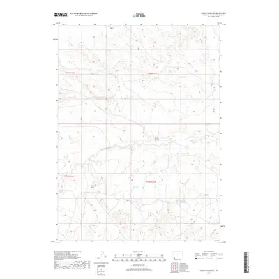
2017 Map of Needle Reservoir
USGS Topo · Published 2017About this map
Needle Reservoir and the high desert plateaus of Sweetwater County define this arid landscape during the mid-2010s. The geography is dominated by drainage patterns and critical water management features essential for life in the Wyoming basin. Small, isolated catchments like Big Hollow Reservoir and Badlands Reservoir dot the terrain, catching seasonal runoff in an otherwise dry environment. The topographic relief is marked by notable high points such as Antelope Knoll, which overlooks a series of erosion-carved channels including Tin Can Draw and Cattail Draw. This survey captures the sparse infrastructure of the region, emphasizing the importance of hydrology and land management in a territory primarily defined by its natural landforms and elevation changes.
Find a feature on this map
10 named features on this map. Tap any name to fly to it.
Don’t see what you’re looking for? This feature index may not catch every label — zoom into the map to look around manually.
Map Details
Editions of this 2017 Needle Reservoir Map
This is the sole edition of this map. No revisions or reprints were ever made.
Other maps of this area

1954 · Ogden
USGS Topo · 1:250,000

1954 · Rock Springs
USGS Topo · 1:250,000

1958 · Ogden
USGS Topo · 1:250,000

1958 · Rock Springs
USGS Topo · 1:250,000

1960 · Ogden
USGS Topo · 1:250,000

1962 · Rock Springs
USGS Topo · 1:250,000

1964 · Butcher Knife Draw
USGS Topo · 1:24,000

1964 · Soap Holes Reservoir
USGS Topo · 1:24,000

1964 · Antelope Knoll NE
USGS Topo · 1:24,000

1964 · Black Spring Reservoir
USGS Topo · 1:24,000