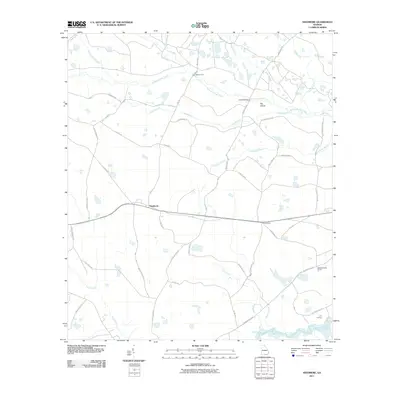
2011 Map of Needmore
USGS Topo · Published 2011About this map
Suwannoochee Creek and its many tributaries, including Cowhouse Branch, dominate this landscape in southern Echols County. The small settlement of Needmore serves as a central point in a network of rural roads with evocative names like Gopher Lope Rd and Cabbage Head Rd. This 2011 survey reveals a landscape defined by its hydrology, where numerous branches and breaks feed into larger systems like the Suwannee River at the southern edge of the quadrangle. Points of passage across the wetlands are noted by features such as Mattox Ford and Double Bridges. The presence of several camps, such as Pierce Camp and Weatherington Camp, alongside Log Landing, suggests a modern land use still deeply tied to the timber and natural resources of the Georgia pine woods and river basins.
Find a feature on this map
48 named features on this map. Tap any name to fly to it.
Don’t see what you’re looking for? This feature index may not catch every label — zoom into the map to look around manually.
Map Details
Editions of this 2011 Needmore Map
This is the sole edition of this map. No revisions or reprints were ever made.
Other maps of this area

1954 · Valdosta
USGS Topo · 1:250,000

1955 · Council
USGS Topo · 1:24,000

1955 · Cypress Creek
USGS Topo · 1:24,000

1955 · Fargo SW
USGS Topo · 1:24,000

1958 · Valdosta
USGS Topo · 1:250,000

1959 · Valdosta
USGS Topo · 1:250,000

1967 · Colon
USGS Topo · 1:24,000

1967 · Fargo
USGS Topo · 1:24,000

1968 · Needmore
USGS Topo · 1:24,000

1968 · Headlight
USGS Topo · 1:24,000