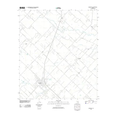
2010 Map of Needville
USGS Topo · Published 2010About this map
Needville anchors the southwestern portion of this coastal prairie landscape, its grid of streets giving way to a network of rural roads that follow the winding paths of several regional waterways. The drainage pattern here is defined by the southeasterly flow of Big Creek, Fairchilds Creek, and Buffalo Creek, which carve through the flat agricultural terrain. The presence of the Big Creek Oil Field in the northeast corner points to the enduring industrial importance of petroleum extraction in Fort Bend County. Smaller settlements like Fairchilds and Pleak are linked by a series of Farm to Market roads, reflecting the post-war expansion of the Texas highway system into rural farming communities. Genealogists and local historians will find value in the specific locations of Concord Cemetery and Cesinger Cemetery, while the Foster School and Bowers Airpark mark local landmarks of education and general aviation.
Find a feature on this map
61 named features on this map. Tap any name to fly to it.
Don’t see what you’re looking for? This feature index may not catch every label — zoom into the map to look around manually.
Map Details
Editions of this 2010 Needville Map
This is the sole edition of this map. No revisions or reprints were ever made.
Other maps of this area

1950 · Houston
USGS Topo · 1:250,000

1953 · Needville
USGS Topo · 1:24,000

1953 · Guy
USGS Topo · 1:24,000

1953 · Lake George
USGS Topo · 1:24,000

1953 · Kendleton
USGS Topo · 1:24,000

1953 · Damon
USGS Topo · 1:24,000

1953 · Boling
USGS Topo · 1:24,000

1955 · Sugar Land
USGS Topo · 1:62,500

1955 · Richmond
USGS Topo · 1:62,500

1956 · Houston
USGS Topo · 1:250,000