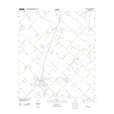
2013 Map of Needville
USGS Topo · Published 2013About this map
The city of Needville and the village of Fairchilds define the residential landscape of this southeast Texas region, which is heavily shaped by an intricate system of natural drainage. Fairchilds Cr, Buffalo Cr, and Seabourne Cr wind through the coastal prairie, illustrating the area's agricultural and hydrologic character. A distinct industrial footprint is evident to the east, marked by Gulf Oil Big Creek Field Rd and Challenger Rig 35, indicating the importance of energy extraction alongside rural life. Historic community sites like the Foster School and small rural burial grounds, including Concord Cem and Cesinger Cem, provide essential anchor points for genealogists tracing family roots in this corner of Fort Bend County. The map also captures the settlement of Pleak to the north, connected by a network of farm-to-market roads that bridge the gap between historic homesteads and modern development.
Find a feature on this map
146 named features on this map. Tap any name to fly to it.
Don’t see what you’re looking for? This feature index may not catch every label — zoom into the map to look around manually.
Map Details
Editions of this 2013 Needville Map
This is the sole edition of this map. No revisions or reprints were ever made.
Other maps of this area

1950 · Houston
USGS Topo · 1:250,000

1953 · Needville
USGS Topo · 1:24,000

1953 · Guy
USGS Topo · 1:24,000

1953 · Lake George
USGS Topo · 1:24,000

1953 · Kendleton
USGS Topo · 1:24,000

1953 · Damon
USGS Topo · 1:24,000

1953 · Boling
USGS Topo · 1:24,000

1955 · Sugar Land
USGS Topo · 1:62,500

1955 · Richmond
USGS Topo · 1:62,500

1956 · Houston
USGS Topo · 1:250,000