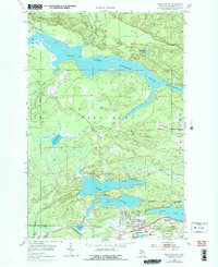
1954 Map of Negaunee SW
USGS Topo · Published 1977About this map
Industrial iron ore production and mid-century urban development define this portion of the Marquette Range. The southern corridor is densely packed with the infrastructure of Ishpeming and Negaunee, where the Ishpeming City Boundary meets extensive mining operations. Significant sites like Mather Mine A and the Cambria-Jackson Mine sit alongside the rail networks of the Chicago and North Western and Lake Superior and Ishpeming railroads, which facilitated the movement of Michigan ore.
Find a feature on this map
35 named features on this map. Tap any name to fly to it.
Don’t see what you’re looking for? This feature index may not catch every label — zoom into the map to look around manually.
Map Details
Editions of this 1954 Negaunee SW Map
4 editions found
Other maps of this area

1952 · Ishpeming
USGS Topo · 1:62,500

1952 · Ishpeming
USGS Topo · 1:24,000

1952 · Palmer
USGS Topo · 1:24,000

1953 · Negaunee
USGS Topo · 1:24,000

1954 · Negaunee SW
USGS Topo · 1:24,000

1954 · Negaunee
USGS Topo · 1:62,500

1955 · Diorite
USGS Topo · 1:24,000

1955 · Greenwood
USGS Topo · 1:24,000

1955 · Republic
USGS Topo · 1:62,500

1955 · Champion
USGS Topo · 1:62,500