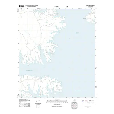
2010 Map of Negreet SW
USGS Topo · Published 2010About this map
The vast expanse of the Toledo Bend Reservoir dominates this 2010 survey of Sabine Parish, illustrating how the damming of the Sabine River permanently reshaped the Louisiana-Texas borderlands. Along the intricate, flooded shoreline, numerous family-named landmarks and historical sites remain preserved in the nomenclature of the surrounding terrain. To the north, the Isaac Low Cemetery sits near El Camino Rd, a reminder of early settlement patterns in this timber-rich region.
Find a feature on this map
27 named features on this map. Tap any name to fly to it.
Don’t see what you’re looking for? This feature index may not catch every label — zoom into the map to look around manually.
Map Details
Editions of this 2010 Negreet SW Map
This is the sole edition of this map. No revisions or reprints were ever made.
Other maps of this area

1944 · Negreet
USGS Topo · 1:62,500

1944 · Wiergate
USGS Topo · 1:62,500

1948 · Wiergate
USGS Topo · 1:62,500

1953 · Alexandria
USGS Topo · 1:250,000

1954 · Toro
USGS Topo · 1:24,000

1954 · Columbus
USGS Topo · 1:24,000

1954 · Fairdale
USGS Topo · 1:24,000
1954 · Negreet
USGS Topo · 1:24,000

1954 · Negreet
USGS Topo · 1:62,500

1954 · Wiergate
USGS Topo · 1:62,500