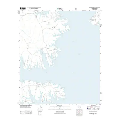
2012 Map of Negreet SW
USGS Topo · Published 2012About this map
Toledo Bend Reservoir dominates the landscape of Sabine Parish, where its intricate, fingered shoreline creates a complex geography of peninsulas and sheltered coves. This 2012 survey documents the recreational and residential development along the eastern banks, characterized by a dense network of local roads such as Geronimo Loop and Butler Point Rd. Amidst the modern lakefront properties, deeper historical layers remain visible through features like Isaac Low Cem, Oak Hill Cem, and McCord Cem, which mark the high ground above the flooded river valley. The terrain is defined by low-lying elevations such as Rock Hill and Sand Hill, while the Sabine Lookout Tower stands as a focal point for land management near Lakeview RD. The presence of El Camino in the northern reach suggests an enduring connection to the region's early transportation corridors.
Find a feature on this map
45 named features on this map. Tap any name to fly to it.
Don’t see what you’re looking for? This feature index may not catch every label — zoom into the map to look around manually.
Map Details
Editions of this 2012 Negreet SW Map
This is the sole edition of this map. No revisions or reprints were ever made.
Other maps of this area

1944 · Negreet
USGS Topo · 1:62,500

1944 · Wiergate
USGS Topo · 1:62,500

1948 · Wiergate
USGS Topo · 1:62,500

1953 · Alexandria
USGS Topo · 1:250,000

1954 · Toro
USGS Topo · 1:24,000

1954 · Columbus
USGS Topo · 1:24,000

1954 · Fairdale
USGS Topo · 1:24,000
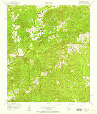
1954 · Negreet
USGS Topo · 1:24,000

1954 · Negreet
USGS Topo · 1:62,500

1954 · Wiergate
USGS Topo · 1:62,500