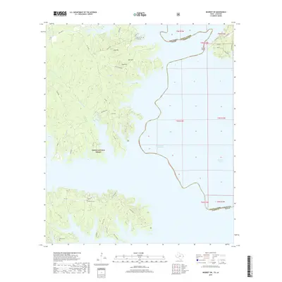
2019 Map of Negreet SW
USGS Topo · Published 2019About this map
Toledo Bend Reservoir dominates this landscape along the border of Louisiana and Texas, where the waters of the Sabine River back into deep inlets and bayous. In this 2019 survey, the intricate shoreline of the reservoir is defined by family-named points and ridges like Rock Hill, Sand Hill, and Moss Hill. The map documents a blend of public timberlands within the Sabine National Forest and private tracts accessed by a network of forest roads and local lanes. Several historic burial sites, including the Isaac Low Cem, Oak Hill Cem, and McCord Cem, are preserved across the terrain, offering significant touchstones for genealogical research in Sabine Parish. The drainage patterns of Hurricane Bayou and Blackland Slough illustrate the natural hydrography of the region before and after the reservoir's development.
Find a feature on this map
48 named features on this map. Tap any name to fly to it.
Don’t see what you’re looking for? This feature index may not catch every label — zoom into the map to look around manually.
Map Details
Editions of this 2019 Negreet SW Map
This is the sole edition of this map. No revisions or reprints were ever made.
Other maps of this area

1944 · Negreet
USGS Topo · 1:62,500

1944 · Wiergate
USGS Topo · 1:62,500

1948 · Wiergate
USGS Topo · 1:62,500

1953 · Alexandria
USGS Topo · 1:250,000

1954 · Toro
USGS Topo · 1:24,000

1954 · Columbus
USGS Topo · 1:24,000

1954 · Fairdale
USGS Topo · 1:24,000
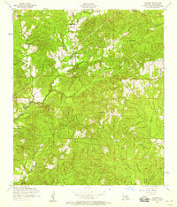
1954 · Negreet
USGS Topo · 1:24,000

1954 · Negreet
USGS Topo · 1:62,500

1954 · Wiergate
USGS Topo · 1:62,500