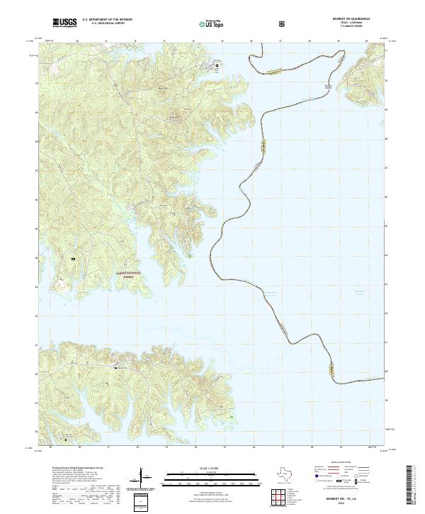
2022 Map of Negreet SW
USGS Topo · Published 2022About this map
The Sabine National Forest dominates this section of the Texas-Louisiana border, where the sprawling Toledo Bend Reservoir follows the submerged channel of the Sabine River. The landscape is characterized by its intricate shoreline, where numerous inlets and bayous like Hurricane Bayou and Ashmore Br carve into the upland pine woods. Prominent high points such as Sand Hill, Rock Hill, and Knox Knol rise above the water's edge, reflecting the local topography of the Sabine Uplift. For those tracing family histories in Sabine County, several burial sites are documented along the ridge lines, including Isaac Low Cem near El Camino and Oak Hill Cem further south. The map illustrates the contemporary boundary between Sabine County, Texas, and Sabine Parish, Louisiana, anchored by landmarks like Gordon Shoals in the upper reaches of the reservoir.
Find a feature on this map
55 named features on this map. Tap any name to fly to it.
Don’t see what you’re looking for? This feature index may not catch every label — zoom into the map to look around manually.
Map Details
Editions of this 2022 Negreet SW Map
This is the sole edition of this map. No revisions or reprints were ever made.
Other maps of this area

1944 · Negreet
USGS Topo · 1:62,500

1944 · Wiergate
USGS Topo · 1:62,500

1948 · Wiergate
USGS Topo · 1:62,500

1953 · Alexandria
USGS Topo · 1:250,000

1954 · Toro
USGS Topo · 1:24,000

1954 · Columbus
USGS Topo · 1:24,000

1954 · Fairdale
USGS Topo · 1:24,000
1954 · Negreet
USGS Topo · 1:24,000

1954 · Negreet
USGS Topo · 1:62,500

1954 · Wiergate
USGS Topo · 1:62,500