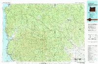
1979 Map of Nehalem River
USGS Topo · Published 1980About this map
Clatsop State Forest and Tillamook State Forest dominate this landscape, where the northern Oregon coast meets the inland timberlands of the Coast Range. The map details the intricate drainage basins of the Nehalem River, Wilson River, and Miami River, which have long defined the region's transport and economy. Coastal settlements such as Seaside, Cannon Beach, and Manzanita are mapped alongside the interior logging and rail towns of Vernonia and Banks. The heavy infrastructure required for the timber industry is evident in the winding route of the Southern Pacific railroad and numerous mountain roads like the Sunset Highway. Notable landmarks such as Neahkahnie Mtn and Haystack Rock anchor the shoreline, while inland, the network of river forks and creeks reveals the topography that shaped local communities like Elsie and Mist during the late twentieth century.
Find a feature on this map
151 named features on this map. Tap any name to fly to it.
Don’t see what you’re looking for? This feature index may not catch every label — zoom into the map to look around manually.
Map Details
Editions of this 1979 Nehalem River Map
3 editions found
Other maps of this area

1915 · Hillsboro
USGS Topo · 1:62,500

1916 · Tualatin
USGS Topo · 1:62,500

1918 · Hillsboro
USGS Topo · 1:62,500

1919 · Mayger
USGS Topo · 1:62,500

1919 · Astoria
USGS Topo · 1:62,500

1921 · Kalama
USGS Topo · 1:62,500

1922 · St. Helens
USGS Topo · 1:62,500

1937 · Nehalem
USGS Topo · 1:62,500

1937 · Enright
USGS Topo · 1:62,500

1939 · Astoria
USGS Topo · 1:62,500