
1940 Map of Nehawka
USGS Topo · Published 1940About this map
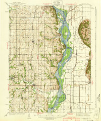
The Missouri River defines this 1940 survey of the Nebraska-Iowa borderlands, snaking through a wide floodplain where Noddleman Island and Goose Island break the current. On the Nebraska bluffs, a dense network of country schoolhouses like Cottonwood Sch, Jean Sch, and New Hope Sch reflects a rural population at its peak, centered around agricultural hubs like Murray and Nehawka. The landscape is etched with local history, from the Youngs Cem and East Union Cem to the early commercial presence of Sargents Spur along the rail lines.
Find a feature on this map
73 named features on this map. Tap any name to fly to it.
Don’t see what you’re looking for? This feature index may not catch every label — zoom into the map to look around manually.
Map Details
Editions of this 1940 Nehawka Map
3 editions found
Other maps of this area

1893 · Fremont
USGS Topo · 1:125,000

1896 · Fremont
USGS Topo · 1:125,000

1903 · Weeping Water
USGS Topo · 1:125,000

1907 · Nebraska City
USGS Topo · 1:62,500

1929 · Weeping Water
USGS Topo · 1:125,000

1935 · Nehawka
USGS Topo · 1:48,000

1939 · Hamburg
USGS Topo · 1:62,500

1941 · Hamburg
USGS Topo · 1:62,500

1954 · Omaha
USGS Topo · 1:250,000

1955 · Fremont
USGS Topo · 1:250,000