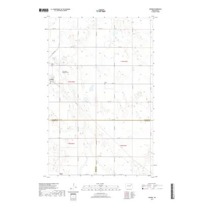
2017 Map of Nekoma
USGS Topo · Published 2017About this map
Nekoma serves as the primary focal point of this prairie landscape, where the rectilinear grid of local roads like Dakota St and Main St meets the natural drainage of the East Branch Nekoma Coulee. This 2017 survey reveals a rural landscape defined by large agricultural tracts and a meticulously surveyed section line road system. Notable cultural landmarks include the Saint Edwards Cem located northwest of the town center and the Nekoma Cem situated along 80th St NE. The convergence of Cavalier, Walsh, and Ramsey counties in the southern portion of the map highlights a significant tri-county boundary point. The terrain is characterized by numerous prairie potholes and wetlands, with the Nekoma Coulee providing the principal drainage for the surrounding fields.
Find a feature on this map
30 named features on this map. Tap any name to fly to it.
Don’t see what you’re looking for? This feature index may not catch every label — zoom into the map to look around manually.
Map Details
Editions of this 2017 Nekoma Map
This is the sole edition of this map. No revisions or reprints were ever made.
Other maps of this area

1953 · Devils Lake
USGS Topo · 1:250,000

1956 · Devils Lake
USGS Topo · 1:250,000

1972 · Osnabrock
USGS Topo · 1:24,000

1972 · Nekoma
USGS Topo · 1:24,000

1972 · Easby
USGS Topo · 1:24,000

1972 · Osnabrock SW
USGS Topo · 1:24,000

1972 · Edmore
USGS Topo · 1:24,000

1972 · Fairdale
USGS Topo · 1:24,000

1972 · Edmore NE
USGS Topo · 1:24,000

1972 · Billings Lake
USGS Topo · 1:24,000