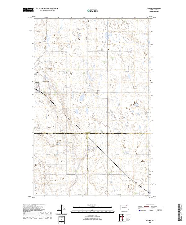
2024 Map of Nekoma
USGS Topo · Published 2024About this map
Nekoma sits at the intersection of rural township lines where Cavalier Co, Ramsey Co, and Walsh Co meet in northeastern North Dakota. The landscape is characterized by a grid of agricultural roads, including 80th St NE and 106th Ave NE, which navigate around numerous prairie potholes and wetlands. The drainage of East Branch Nekoma Coulee provides a natural break in the geometric land divisions of the Public Land Survey System, which are clearly marked by township and range labels like t159n r60w.
Find a feature on this map
33 named features on this map. Tap any name to fly to it.
Don’t see what you’re looking for? This feature index may not catch every label — zoom into the map to look around manually.
Map Details
Editions of this 2024 Nekoma Map
This is the sole edition of this map. No revisions or reprints were ever made.
Other maps of this area

1953 · Devils Lake
USGS Topo · 1:250,000

1956 · Devils Lake
USGS Topo · 1:250,000

1972 · Osnabrock
USGS Topo · 1:24,000

1972 · Nekoma
USGS Topo · 1:24,000

1972 · Easby
USGS Topo · 1:24,000

1972 · Osnabrock SW
USGS Topo · 1:24,000

1972 · Edmore
USGS Topo · 1:24,000

1972 · Fairdale
USGS Topo · 1:24,000

1972 · Edmore NE
USGS Topo · 1:24,000

1972 · Billings Lake
USGS Topo · 1:24,000