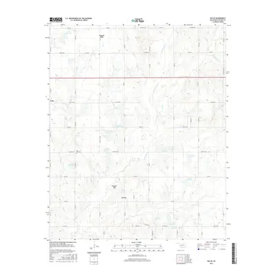
2016 Map of Nellie
USGS Topo · Published 2016About this map
Oil City and Empire City anchor this portion of Stephens County, where a network of section-line roads and numerous numbered reservoirs define the landscape. The terrain is intricately carved by Little Beaver Cr, Rock Cr, and Stage Stand Cr, showing a region heavily managed for water storage as evidenced by features like 137066 Reservoir and 137009 Reservoir. This 2016 survey reflects the modern rural infrastructure of Oklahoma, maintaining traditional landmarks such as the Rock Creek Cem and the settlement of Central High. The dense grid of roads, including E1650 Rd and Blackburn Rd, illustrates how the land was partitioned for agricultural and resource development. The proximity of Nellie on the western edge highlights the dispersed nature of these historic communities and their continued presence into the twenty-first century.
Find a feature on this map
68 named features on this map. Tap any name to fly to it.
Don’t see what you’re looking for? This feature index may not catch every label — zoom into the map to look around manually.
Map Details
Editions of this 2016 Nellie Map
This is the sole edition of this map. No revisions or reprints were ever made.
Other maps of this area

1901 · Addington
USGS Topo · 1:125,000

1902 · Rush Springs
USGS Topo · 1:125,000

1949 · Nellie
USGS Topo · 1:62,500

1950 · Marlow
USGS Topo · 1:62,500

1951 · Marlow
USGS Topo · 1:62,500

1955 · Lawton
USGS Topo · 1:250,000

1956 · Sterling
USGS Topo · 1:24,000
1956 · Denton
USGS Topo · 1:24,000

1956 · Letitia
USGS Topo · 1:24,000

1956 · Nellie
USGS Topo · 1:24,000