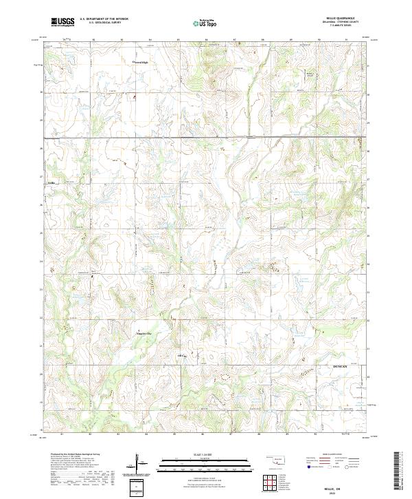
2022 Map of Nellie
USGS Topo · Published 2022About this map
Central High and the rural crossroads of Nellie anchor the northern landscape of this Stephens County region, where the terrain is deeply etched by the drainages of Rock Cr and Little Beaver Cr. The area reflects a classic Oklahoma transition from open ranchland to energy-impacted territory, evidenced by the proximity of Oil City and Empire City to the west of Duncan. Local genealogists and historians will find interest in the isolated Rock Creek Cem, situated near the confluence of several unnamed tributaries.
Find a feature on this map
69 named features on this map. Tap any name to fly to it.
Don’t see what you’re looking for? This feature index may not catch every label — zoom into the map to look around manually.
Map Details
Editions of this 2022 Nellie Map
This is the sole edition of this map. No revisions or reprints were ever made.
Other maps of this area

1901 · Addington
USGS Topo · 1:125,000

1902 · Rush Springs
USGS Topo · 1:125,000

1949 · Nellie
USGS Topo · 1:62,500

1950 · Marlow
USGS Topo · 1:62,500

1951 · Marlow
USGS Topo · 1:62,500

1955 · Lawton
USGS Topo · 1:250,000

1956 · Sterling
USGS Topo · 1:24,000
1956 · Denton
USGS Topo · 1:24,000

1956 · Letitia
USGS Topo · 1:24,000

1956 · Nellie
USGS Topo · 1:24,000