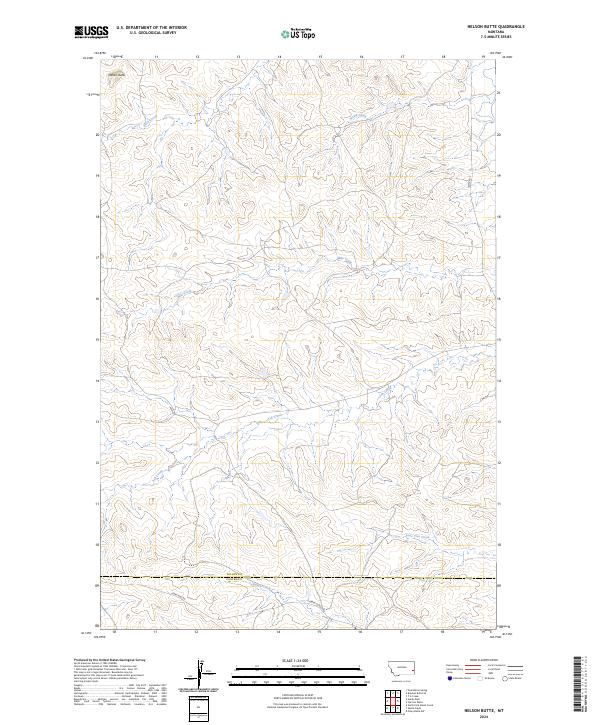
2024 Map of Nelson Butte
USGS Topo · Published 2024About this map
The boundary between Fallon Co and Carter Co serves as the primary dividing line in this high plains landscape. The terrain is characterized by a complex network of intermittent drainages, including the headwaters of Ash Creek, Lone Tree Creek, and Mile Creek, which carve through the land south of the prominent Nelson Butte.
Find a feature on this map
17 named features on this map. Tap any name to fly to it.
Don’t see what you’re looking for? This feature index may not catch every label — zoom into the map to look around manually.
Map Details
Editions of this 2024 Nelson Butte Map
This is the sole edition of this map. No revisions or reprints were ever made.
Other maps of this area

1953 · Miles City
USGS Topo · 1:250,000

1957 · Miles City
USGS Topo · 1:250,000

1958 · Miles City
USGS Topo · 1:250,000

1981 · Baker
USGS Topo · 1:100,000
1981 · Skunk Creek
USGS Topo · 1:24,000

1981 · Harmon Butte
USGS Topo · 1:24,000

1981 · Nelson Butte
USGS Topo · 1:24,000

1981 · Bracket Butte SE
USGS Topo · 1:24,000
1981 · Hooky Dam
USGS Topo · 1:24,000
1981 · North Fork Alkali Creek
USGS Topo · 1:24,000