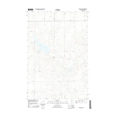
2014 Map of Nelson Lake
USGS Topo · Published 2014About this map
Nelson Lake dominates the central landscape of this Oliver County region, serving as a primary water feature fed by Hagel Creek from the west. The terrain is defined by the prominent Square Butte and the drainage network of Square Butte Cr, which winds through the eastern portion of the quadrangle. This 2014 survey captures the rural infrastructure of the area, characterized by a highly structured grid of section-line roads such as 33rd Ave SW and 25th St SW. The presence of ND-25 crossing the northern section provides the primary east-west transit corridor through this prairie landscape. The map reflects a modern topographical record of the North Dakota plains, where the interplay of managed water resources and agricultural access roads dictates the local geography.
Find a feature on this map
19 named features on this map. Tap any name to fly to it.
Don’t see what you’re looking for? This feature index may not catch every label — zoom into the map to look around manually.
Map Details
Editions of this 2014 Nelson Lake Map
This is the sole edition of this map. No revisions or reprints were ever made.
Other maps of this area

1954 · Bismarck
USGS Topo · 1:250,000

1954 · McClusky
USGS Topo · 1:250,000

1958 · Bismarck
USGS Topo · 1:250,000

1958 · McClusky
USGS Topo · 1:250,000

1968 · Hannover NE
USGS Topo · 1:24,000

1968 · Fort Clark
USGS Topo · 1:24,000
1968 · Fort Clark NE
USGS Topo · 1:24,000

1970 · New Salem NE
USGS Topo · 1:24,000

1972 · Center
USGS Topo · 1:24,000

1972 · Crown Butte NW
USGS Topo · 1:24,000