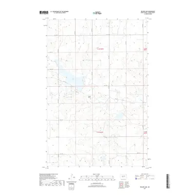
2017 Map of Nelson Lake
USGS Topo · Published 2017About this map
Square Butte stands as a prominent elevation in this corner of Oliver County, overlooking the waters of Nelson Lake. This 2017 survey by the U.S. Geological Survey illustrates a landscape defined by North Dakota's section-line grid, where roads like 24th St SW and 33rd Ave SW trace a rigid geometry across the drainage basins of Hagel Cr and Square Butte Cr. The map captures the intersection of natural hydrology and modern land management, showing how these creek systems interact with the man-made reservoir. For those studying the rural development of the northern plains, the sheet provides exact coordinates for the township boundaries of t142n r83w and t141n r83w, anchoring the agricultural infrastructure within the broader regional topography.
Find a feature on this map
21 named features on this map. Tap any name to fly to it.
Don’t see what you’re looking for? This feature index may not catch every label — zoom into the map to look around manually.
Map Details
Editions of this 2017 Nelson Lake Map
This is the sole edition of this map. No revisions or reprints were ever made.
Other maps of this area

1954 · Bismarck
USGS Topo · 1:250,000

1954 · McClusky
USGS Topo · 1:250,000

1958 · Bismarck
USGS Topo · 1:250,000

1958 · McClusky
USGS Topo · 1:250,000

1968 · Hannover NE
USGS Topo · 1:24,000

1968 · Fort Clark
USGS Topo · 1:24,000
1968 · Fort Clark NE
USGS Topo · 1:24,000

1970 · New Salem NE
USGS Topo · 1:24,000

1972 · Center
USGS Topo · 1:24,000

1972 · Crown Butte NW
USGS Topo · 1:24,000