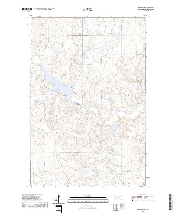
2024 Map of Nelson Lake
USGS Topo · Published 2024About this map
Nelson Lake dominates this portion of the northern plains, serving as a primary hydrologic focal point in a landscape defined by the drainage of Square Butte Creek and Hagel Creek. The topography is marked by the prominent elevation of Square Butte, a distinct landform rising amidst the section lines of Townships 141 and 142 North. This modern survey illustrates the organized grid of rural infrastructure, where a network of section-line roads such as 24th St SW and 33rd Ave SW provide access to the vast agricultural and range lands. The map details the intricate contours of the surrounding drainages, showing how the local coulees and draws feed into the central reservoir and creek systems.
Find a feature on this map
21 named features on this map. Tap any name to fly to it.
Don’t see what you’re looking for? This feature index may not catch every label — zoom into the map to look around manually.
Map Details
Editions of this 2024 Nelson Lake Map
This is the sole edition of this map. No revisions or reprints were ever made.
Other maps of this area

1954 · Bismarck
USGS Topo · 1:250,000

1954 · McClusky
USGS Topo · 1:250,000

1958 · Bismarck
USGS Topo · 1:250,000

1958 · McClusky
USGS Topo · 1:250,000

1968 · Hannover NE
USGS Topo · 1:24,000

1968 · Fort Clark
USGS Topo · 1:24,000
1968 · Fort Clark NE
USGS Topo · 1:24,000

1970 · New Salem NE
USGS Topo · 1:24,000

1972 · Center
USGS Topo · 1:24,000

1972 · Crown Butte NW
USGS Topo · 1:24,000