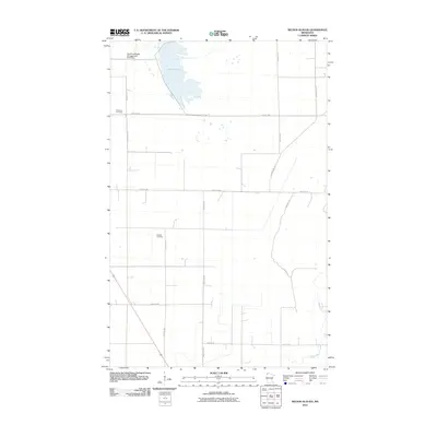
2010 Map of Nelson Slough
USGS Topo · Published 2010About this map
Nelson Slough and the winding course of the Middle River dominate this portion of Marshall County, illustrating a landscape defined by water management and conservation. The northern reaches feature the East Park Wildlife Management Pond Dam, a significant landmark indicating the regional focus on habitat preservation. The map records a grid of section lines and rural roads that connect remote homesteads and local landmarks. For genealogists, the inclusion of Wikstrom Cemetery and Opdahl Cemetery provides precise locations for family history research. This 2010 survey reflects the enduring agricultural and conservation-based character of the area, where trails like Hunting Trl suggest the recreational use of the surrounding wetlands and fields.
Find a feature on this map
18 named features on this map. Tap any name to fly to it.
Don’t see what you’re looking for? This feature index may not catch every label — zoom into the map to look around manually.
Map Details
Editions of this 2010 Nelson Slough Map
This is the sole edition of this map. No revisions or reprints were ever made.
Other maps of this area

1918 · Greenbush
USGS Topo · 1:62,500

1918 · Middle River
USGS Topo · 1:62,500

1919 · Pelan
USGS Topo · 1:62,500

1952 · Thief River Falls
USGS Topo · 1:250,000

1956 · Thief River Falls
USGS Topo · 1:250,000

1957 · Thief River Falls
USGS Topo · 1:250,000

1957 · Newfolden
USGS Topo · 1:62,500

1957 · Pelan
USGS Topo · 1:62,500

1962 · Strathcona
USGS Topo · 1:24,000
1962 · Middle River
USGS Topo · 1:24,000