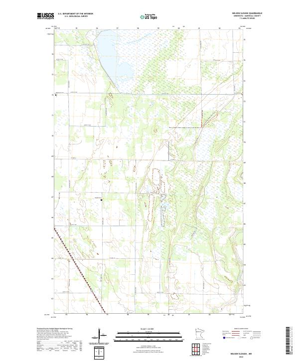
2022 Map of Nelson Slough
USGS Topo · Published 2022About this map
The northern Marshall County landscape is defined by the extensive drainage network of Judicial Ditch Number Nineteen and the winding course of the Middle River. This 2022 survey illustrates the grid of rural section roads and county highways that navigate the wetland-rich terrain typical of the Glacial Lake Agassiz plain. Evidence of early Swedish or Norwegian settlement patterns survives in the presence of the Wikstrom Cem and Opdahl Cem, providing vital coordinates for genealogists tracing local family history. Much of the eastern portion of the map is dedicated to recreational or conservation use, as seen by the Consolidated Conservation Trails Trl and the Hunting Trl. These corridors follow the natural ridges and clearings between marshy lowlands, reflecting a modern land use focused on habitat preservation and managed access in this corner of the Red River Valley watershed.
Find a feature on this map
28 named features on this map. Tap any name to fly to it.
Don’t see what you’re looking for? This feature index may not catch every label — zoom into the map to look around manually.
Map Details
Editions of this 2022 Nelson Slough Map
This is the sole edition of this map. No revisions or reprints were ever made.
Other maps of this area

1918 · Greenbush
USGS Topo · 1:62,500

1918 · Middle River
USGS Topo · 1:62,500

1919 · Pelan
USGS Topo · 1:62,500

1952 · Thief River Falls
USGS Topo · 1:250,000

1956 · Thief River Falls
USGS Topo · 1:250,000

1957 · Thief River Falls
USGS Topo · 1:250,000

1957 · Newfolden
USGS Topo · 1:62,500

1957 · Pelan
USGS Topo · 1:62,500

1962 · Strathcona
USGS Topo · 1:24,000
1962 · Middle River
USGS Topo · 1:24,000