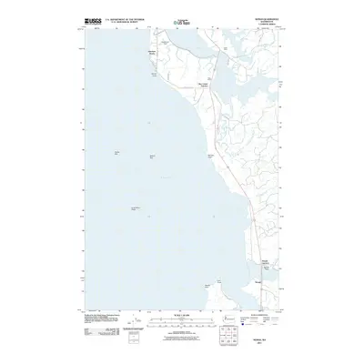
2011 Map of Nemah
USGS Topo · Published 2011About this map
The eastern shores of Willapa Bay define this coastal landscape, where the tidal influence of the Pacific reaches deep into the river systems of Pacific County. The settlement of Nemah sits at the southern edge of the sheet, where Williams Creek meets the bay near the expansive Nemah Flats. Moving north, the map reveals a series of estuarine environments where the Palix River and Niawiakum River wind through the marshlands toward the coast.
Find a feature on this map
31 named features on this map. Tap any name to fly to it.
Don’t see what you’re looking for? This feature index may not catch every label — zoom into the map to look around manually.
Map Details
Editions of this 2011 Nemah Map
This is the sole edition of this map. No revisions or reprints were ever made.
Other maps of this area

1938 · Cape Disappointment
USGS Topo · 1:62,500

1938 · Cape Shoalwater
USGS Topo · 1:62,500

1938 · Fort Columbia
USGS Topo · 1:62,500

1938 · South Bend
USGS Topo · 1:62,500

1940 · South Bend
USGS Topo · 1:62,500

1943 · Fort Columbia
USGS Topo · 1:62,500

1943 · Copalis Beach
USGS Topo · 1:250,000

1949 · Oman Ranch
USGS Topo · 1:24,000

1949 · Ocean Park
USGS Topo · 1:24,000

1949 · Long Island
USGS Topo · 1:24,000