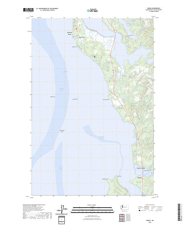
2023 Map of Nemah
USGS Topo · Published 2023About this map
Willapa Bay defines this Pacific County coastline, where the interaction of tides and river mouths creates a complex landscape of spits, shoals, and channels. The settlement of Bay Center sits prominently on a peninsula between the bay and the South Fork Palix River, serving as a central hub for the area's maritime and coastal activity. Further south, the map documents the convergence of land and water at Nemah Junction and the tidal reaches of Nemah Flats, where the Nemah River Channel meets the bay.
Find a feature on this map
37 named features on this map. Tap any name to fly to it.
Don’t see what you’re looking for? This feature index may not catch every label — zoom into the map to look around manually.
Map Details
Editions of this 2023 Nemah Map
This is the sole edition of this map. No revisions or reprints were ever made.
Other maps of this area

1938 · Cape Disappointment
USGS Topo · 1:62,500

1938 · Cape Shoalwater
USGS Topo · 1:62,500

1938 · Fort Columbia
USGS Topo · 1:62,500

1938 · South Bend
USGS Topo · 1:62,500

1940 · South Bend
USGS Topo · 1:62,500

1943 · Fort Columbia
USGS Topo · 1:62,500

1943 · Copalis Beach
USGS Topo · 1:250,000

1949 · Oman Ranch
USGS Topo · 1:24,000

1949 · Ocean Park
USGS Topo · 1:24,000

1949 · Long Island
USGS Topo · 1:24,000