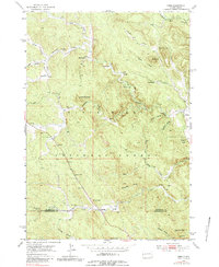
1953 Map of Nemo
USGS Topo · Published 1983About this map
Greenwood and Nemo anchor this detailed study of the Black Hills National Forest as it appeared in the early 1950s. The landscape is defined by the winding course of Boxelder Creek and its many tributaries, including Blue Draw Creek and North Fork Estes Creek. Settlement is sparse, concentrated in small outposts and timber-rich valleys where legacy sites like the Lucky Strike Mine and Hillside School appear alongside organized recreation areas such as Scout Camp and Boxelder Camp. The map clearly delineates the Lawrence and Pennington County boundary line, which crosses the rugged terrain between Pilot Knob and Merritt. This 1953 field-checked data preserves a specific moment in the Black Hills, showing the complex network of draws and peaks like Crystal Mountain and White Mansion before modern development altered the forest's interior character.
Find a feature on this map
35 named features on this map. Tap any name to fly to it.
Don’t see what you’re looking for? This feature index may not catch every label — zoom into the map to look around manually.
Map Details
Editions of this 1953 Nemo Map
5 editions found
Other maps of this area

1893 · Rapid
USGS Topo · 1:125,000

1894 · Deadwood
USGS Topo · 1:125,000

1898 · Rapid
USGS Topo · 1:125,000

1899 · Sturgis
USGS Topo · 1:62,500

1901 · Deadwood
USGS Topo · 1:125,000

1903 · Rapid
USGS Topo · 1:125,000

1915 · Sturgis
USGS Topo · 1:62,500

1916 · Deadwood
USGS Topo · 1:125,000

1953 · Piedmont
USGS Topo · 1:24,000

1953 · Nemo
USGS Topo · 1:24,000