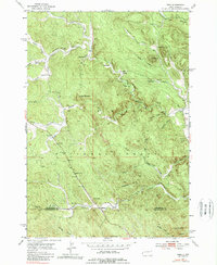
1953 Map of Nemo
USGS Topo · Published 1989About this map
Black Hills National Forest land dominates this 1950s study of the South Dakota backcountry, where the landscape is defined by the complex drainage systems of Boxelder Creek. The small settlement of Nemo serves as a primary point of reference on the eastern edge of the sheet, situated near a Cem and several specialized forest clearings including a Scout Camp. Further west, the map records industrial and educational markers of earlier mountain life, such as the Lucky Strike Mine and the Hillside Sch, providing evidence of the scattered communities that supported timber and mineral extraction.
Find a feature on this map
36 named features on this map. Tap any name to fly to it.
Don’t see what you’re looking for? This feature index may not catch every label — zoom into the map to look around manually.
Map Details
Editions of this 1953 Nemo Map
5 editions found
Other maps of this area

1893 · Rapid
USGS Topo · 1:125,000

1894 · Deadwood
USGS Topo · 1:125,000

1898 · Rapid
USGS Topo · 1:125,000

1899 · Sturgis
USGS Topo · 1:62,500

1901 · Deadwood
USGS Topo · 1:125,000

1903 · Rapid
USGS Topo · 1:125,000

1915 · Sturgis
USGS Topo · 1:62,500

1916 · Deadwood
USGS Topo · 1:125,000

1953 · Piedmont
USGS Topo · 1:24,000

1953 · Nemo
USGS Topo · 1:24,000