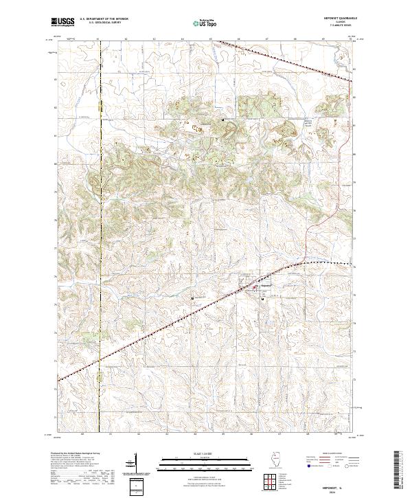
2024 Map of Neponset
USGS Topo · Published 2024About this map
The village of Neponset serves as the primary focal point of this Illinois survey, situated along the corridor where W Main St and Bureau St meet. This agrarian landscape is defined by its transition from the northern uplands, including Indian Hill, to the southern drainage basins. Water management and natural flow are central to the terrain, with the Barbara Ditch in the north and the meandering paths of Coal Creek, Lawson Creek, and Mud Creek shaping the topography. To the south, the headwaters of the East Fork Spoon River emerge, illustrating the area's role in the regional watershed.
Find a feature on this map
69 named features on this map. Tap any name to fly to it.
Don’t see what you’re looking for? This feature index may not catch every label — zoom into the map to look around manually.
Map Details
Editions of this 2024 Neponset Map
This is the sole edition of this map. No revisions or reprints were ever made.
Other maps of this area

1921 · Buda
USGS Topo · 1:62,500

1923 · Buda
USGS Topo · 1:62,500

1929 · Annawan
USGS Topo · 1:62,500

1932 · Annawan
USGS Topo · 1:62,500

1933 · Camp Grove
USGS Topo · 1:48,000

1944 · Kewanee
USGS Topo · 1:62,500

1945 · Bradford
USGS Topo · 1:62,500

1958 · Aurora
USGS Topo · 1:250,000

1961 · Aurora
USGS Topo · 1:250,000
1983 · Annawan
USGS Topo · 1:24,000