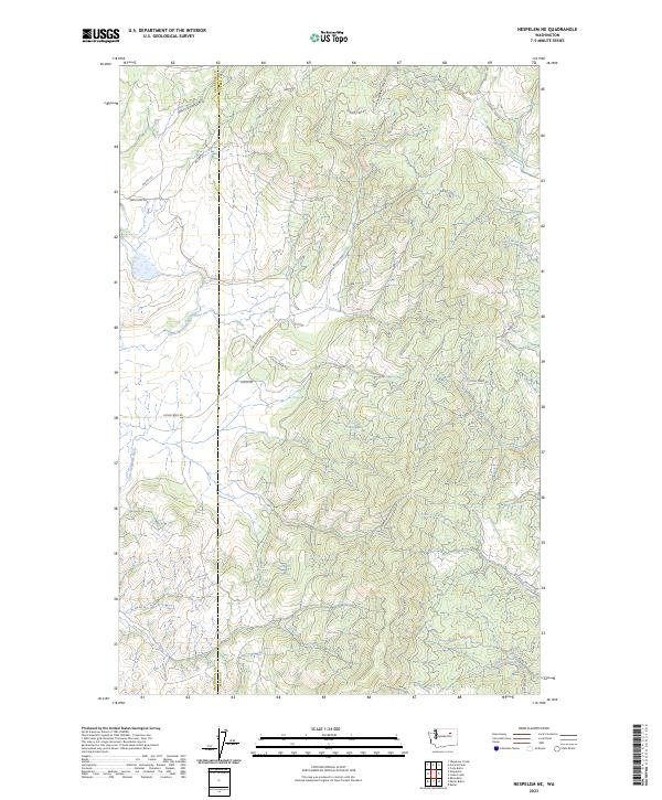
2023 Map of Nespelem NE
USGS Topo · Published 2023About this map
The Little Nespelem River winds through this interior landscape of Ferry and Okanogan counties, where a network of Bureau of Indian Affairs roads facilitates access to the high-elevation drainages of the Colville Indian Reservation. The map detail reflects a modern era of resource management and rural infrastructure, centered on vital water systems like Cache Creek and Lime Creek. The presence of Owhi Fish Hatchery Rd and Jack Creek Access Rd points to the continued importance of fisheries and public land access in this region. Numerous creeks, including Capoose Creek and McAllister Creek, define the complex topography that stretches toward the Central Peak Rd and Keller Butte Rd. This survey serves as a precise record of the road networks and water bodies that sustain this high-plateau environment in the early twenty-first century.
Find a feature on this map
35 named features on this map. Tap any name to fly to it.
Don’t see what you’re looking for? This feature index may not catch every label — zoom into the map to look around manually.
Map Details
Editions of this 2023 Nespelem NE Map
This is the sole edition of this map. No revisions or reprints were ever made.
Other maps of this area

1950 · Nespelem
USGS Topo · 1:62,500

1952 · Keller
USGS Topo · 1:62,500

1953 · Seventeenmile Mtn.
USGS Topo · 1:62,500

1953 · Bald Knob
USGS Topo · 1:62,500

1954 · Okanogan
USGS Topo · 1:250,000

1958 · Okanogan
USGS Topo · 1:250,000

1984 · Nespelem
USGS Topo · 1:100,000

1986 · Central Peak
USGS Topo · 1:24,000
1989 · Keller
USGS Topo · 1:24,000
1989 · Stepstone Creek
USGS Topo · 1:24,000