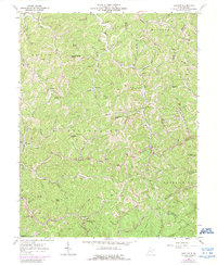
1962 Map of Nestlow
USGS Topo · Published 1989About this map
Deeply dissected ridges and winding hollows characterize this corner of West Virginia where the Left Fork Big Sandy River and its numerous tributaries have carved the landscape. The map shows a scattered rural population concentrated along narrow valley floors and ridgelines, with small settlements like Nestlow and Gilkerson serving as local hubs. The region is defined by a dense network of family-named landmarks and cemeteries, such as Crockett Cem and Bradshaw Cem, which reflect generations of settlement in these hills.
Find a feature on this map
115 named features on this map. Tap any name to fly to it.
Don’t see what you’re looking for? This feature index may not catch every label — zoom into the map to look around manually.
Map Details
Editions of this 1962 Nestlow Map
3 editions found
Other maps of this area

1892 · Huntington
USGS Topo · 1:125,000

1898 · Huntington
USGS Topo · 1:125,000

1901 · Guyandot
USGS Topo · 1:62,500

1902 · Guyandot
USGS Topo · 1:62,500

1902 · Milton
USGS Topo · 1:62,500

1902 · Midkiff
USGS Topo · 1:62,500

1907 · Midkiff
USGS Topo · 1:62,500

1909 · Wayne
USGS Topo · 1:62,500

1909 · Midkiff
USGS Topo · 1:62,500

1931 · Wayne
USGS Topo · 1:62,500