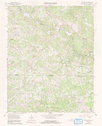
1967 Map of Nettleridge
USGS Topo · Published 1991About this map
South Mayo River and Smith River carve through the landscape along the Virginia-North Carolina border, defining a region of small rural settlements and country crossroads. This mid-century survey captures the community of Nettleridge and several rural commerce hubs such as Moorefield Store and Lackey Store. The map is particularly dense with historic religious landmarks, including Tatum Macedonia Ch, Trinity Ch, and High Point Ch, alongside numerous family burial grounds marked simply as cemeteries. Industrial history is represented by Gilbert Mill on Russell Creek, while the surveyor's precision is noted by a Gaging Sta on the riverbank. This map provides a detailed view of the Patrick and Stokes County line before modern development altered the rural road and settlement patterns of the upper Piedmont.
Find a feature on this map
40 named features on this map. Tap any name to fly to it.
Don’t see what you’re looking for? This feature index may not catch every label — zoom into the map to look around manually.
Map Details
Editions of this 1967 Nettleridge Map
3 editions found
Other maps of this area

1926 · Critz
USGS Topo · 1:48,000

1928 · Stuart
USGS Topo · 1:48,000

1928 · Critz
USGS Topo · 1:62,500

1931 · Stuart
USGS Topo · 1:62,500

1953 · Winston-Salem
USGS Topo · 1:250,000

1955 · Winston-Salem
USGS Topo · 1:250,000

1962 · Winston-Salem
USGS Topo · 1:250,000

1964 · Hanging Rock
USGS Topo · 1:24,000

1967 · Patrick Springs
USGS Topo · 1:24,000
1967 · Spencer
USGS Topo · 1:24,000