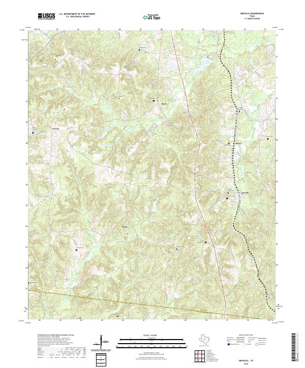
2022 Map of Neuville
USGS Topo · Published 2022About this map
Neuville and Brady anchor this rural landscape in East Texas, where the terrain is defined by the winding drainages of Mill Cr and Brady Cr. The map reveals a high density of small family and community burial grounds, such as Spann's Chapel Cem, Frank Potts Cem, and the Clever Creek Cem near Choice. These locations, often situated along winding county roads like Co RD 1017 and Co RD 1012, provide essential touchstones for genealogical research in this part of Shelby County.
Find a feature on this map
86 named features on this map. Tap any name to fly to it.
Don’t see what you’re looking for? This feature index may not catch every label — zoom into the map to look around manually.
Map Details
Editions of this 2022 Neuville Map
This is the sole edition of this map. No revisions or reprints were ever made.
Other maps of this area

1953 · Palestine
USGS Topo · 1:250,000

1957 · Palestine
USGS Topo · 1:250,000

1958 · Center
USGS Topo · 1:62,500

1958 · San Augustine
USGS Topo · 1:62,500

1958 · Martinsville
USGS Topo · 1:62,500

1958 · Timpson
USGS Topo · 1:62,500

1984 · Palestine
USGS Topo · 1:250,000
1984 · Center
USGS Topo · 1:24,000
1984 · San Augustine East
USGS Topo · 1:24,000
1984 · Hurstown
USGS Topo · 1:24,000