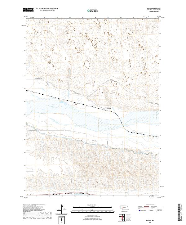
2021 Map of Nevens
USGS Topo · Published 2021About this map
The North Platte River and South Platte River both cross this portion of Keith County, creating a landscape defined by Nebraska's vital water management systems. The central settlement of Nevens sits just north of the Platte's braided channels, serving as a landmark in a region dominated by intricate irrigation infrastructure. A complex network of waterways, including the Keith Lincoln Canal, the Sutherland Canal, and the Paxton Canal, illustrate the intensive engineering required to support agriculture in the Platte Valley. North of the river, the terrain transitions into the Sandhills, where ephemeral drainages like Sand Creek, Skunk Cr, and Duck Cr carve through the upland rises. This 2021 survey documents the persistent relationship between the river corridor's transport routes, such as Keystone Sarben N Rd, and the critical hydraulic systems that sustain the surrounding plains.
Find a feature on this map
19 named features on this map. Tap any name to fly to it.
Don’t see what you’re looking for? This feature index may not catch every label — zoom into the map to look around manually.
Map Details
Editions of this 2021 Nevens Map
This is the sole edition of this map. No revisions or reprints were ever made.
Other maps of this area

1897 · Ogallala
USGS Topo · 1:125,000

1898 · Paxton
USGS Topo · 1:125,000

1900 · Ogallala
USGS Topo · 1:125,000

1901 · Paxton
USGS Topo · 1:125,000

1954 · North Platte
USGS Topo · 1:250,000

1956 · North Platte
USGS Topo · 1:250,000

1957 · North Platte
USGS Topo · 1:250,000

1967 · North Platte
USGS Topo · 1:250,000
1971 · Ogallala SE
USGS Topo · 1:24,000
1971 · Paxton South
USGS Topo · 1:24,000