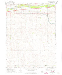
1971 Map of Paxton South
USGS Topo · Published 1974About this map
The South Platte River valley dominates this early 1970s landscape, serving as a critical corridor for transportation and water management. The town of Paxton is situated in the north, anchored by the Union Pacific railroad and Interstate 80. This survey highlights the complex engineering of the High Plains, where the Sutherland Canal and South Platte Supply Canal cut across the terrain to manage the region's water resources. Evidence of local community life appears in the southern portion of the map at School No 16, while the Paxton Cem lies just south of the main settlement. The presence of several Gravel Pit locations along the river indicates the importance of local material extraction for the infrastructure of Keith and Lincoln counties during this period.
Find a feature on this map
14 named features on this map. Tap any name to fly to it.
Don’t see what you’re looking for? This feature index may not catch every label — zoom into the map to look around manually.
Map Details
Editions of this 1971 Paxton South Map
This is the sole edition of this map. No revisions or reprints were ever made.
Other maps of this area

1898 · Paxton
USGS Topo · 1:125,000

1901 · Paxton
USGS Topo · 1:125,000

1954 · McCook
USGS Topo · 1:250,000

1954 · North Platte
USGS Topo · 1:250,000

1956 · North Platte
USGS Topo · 1:250,000

1957 · North Platte
USGS Topo · 1:250,000

1957 · McCook
USGS Topo · 1:250,000

1958 · McCook
USGS Topo · 1:250,000

1967 · North Platte
USGS Topo · 1:250,000

1971 · Sutherland Reservoir West
USGS Topo · 1:24,000