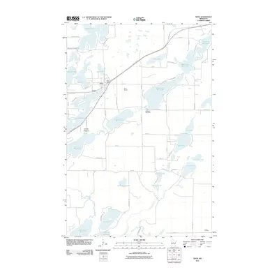
2010 Map of Nevis
USGS Topo · Published 2010About this map
Nevis serves as the central hub of this northern Minnesota landscape, where the Nevis Post Office and Nevis Airport anchor a region defined by its complex glacial hydrology. The area is dominated by the sprawling chain of the Crow Wing River, which connects a numbered series of water bodies including Tenth Crow Wing Lake, Ninth Crow Wing Lake, and Eighth Crow Wing Lake. Control of these waters is marked by the Crow Wing 8th Lake Dam, illustrating the managed nature of the local watershed.
Find a feature on this map
71 named features on this map. Tap any name to fly to it.
Don’t see what you’re looking for? This feature index may not catch every label — zoom into the map to look around manually.
Map Details
Editions of this 2010 Nevis Map
This is the sole edition of this map. No revisions or reprints were ever made.
Other maps of this area

1953 · Brainerd
USGS Topo · 1:250,000

1954 · Bemidji
USGS Topo · 1:250,000

1957 · Brainerd
USGS Topo · 1:250,000

1957 · Bemidji
USGS Topo · 1:250,000

1958 · Bemidji
USGS Topo · 1:250,000

1958 · Brainerd
USGS Topo · 1:250,000

1965 · Brainerd
USGS Topo · 1:250,000

1970 · Nevis
USGS Topo · 1:24,000

1970 · Dorset
USGS Topo · 1:24,000
1970 · Huntersville
USGS Topo · 1:24,000