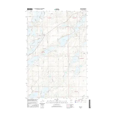
2016 Map of Nevis
USGS Topo · Published 2016About this map
Nevis serves as the central hub of this lake-studded landscape in Hubbard County, where the town’s grid meets the recreational and ecological corridor of the Bunyan Trails Rd. The geography is defined by a dense sequence of water bodies, notably the numbered chain of the Crow Wing River system, including Eighth Crow Wing Lake and Seventh Crow Wing Lake. These lakes, along with the irregular shoreline of Lake Belle Taine, illustrate the post-glacial topography of the region, where water and wetland dominate the transit patterns.
Find a feature on this map
90 named features on this map. Tap any name to fly to it.
Don’t see what you’re looking for? This feature index may not catch every label — zoom into the map to look around manually.
Map Details
Editions of this 2016 Nevis Map
This is the sole edition of this map. No revisions or reprints were ever made.
Other maps of this area

1953 · Brainerd
USGS Topo · 1:250,000

1954 · Bemidji
USGS Topo · 1:250,000

1957 · Brainerd
USGS Topo · 1:250,000

1957 · Bemidji
USGS Topo · 1:250,000

1958 · Bemidji
USGS Topo · 1:250,000

1958 · Brainerd
USGS Topo · 1:250,000

1965 · Brainerd
USGS Topo · 1:250,000

1970 · Nevis
USGS Topo · 1:24,000

1970 · Dorset
USGS Topo · 1:24,000
1970 · Huntersville
USGS Topo · 1:24,000