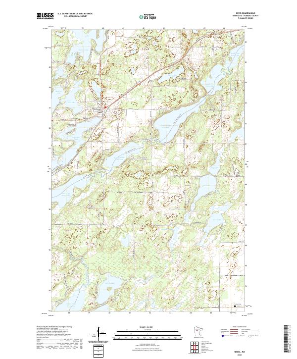
2022 Map of Nevis
USGS Topo · Published 2022About this map
The town of Nevis sits at the heart of a complex glacial landscape defined by the interconnected waters of the Crow Wing River system. This 2022 survey details a series of numbered lakes, including Fourth, Sixth, Seventh, Eighth, Ninth, and Tenth Crow Wing Lake, which form a natural corridor through Hubbard County. The settlement pattern is anchored by the crossing of the Heartland State Trl and Bunyan Trails Rd, reflecting the region's transition from early 20th-century rail routes to modern recreational pathways. Genealogists will find the locations of Lakeview Cem near the town center and Lemon Cem to the southeast, while the inclusion of the Hay Acres Airport and various township roads like Twp Rd 22-1 illustrates the contemporary rural infrastructure supporting these lakeside communities.
Find a feature on this map
97 named features on this map. Tap any name to fly to it.
Don’t see what you’re looking for? This feature index may not catch every label — zoom into the map to look around manually.
Map Details
Editions of this 2022 Nevis Map
This is the sole edition of this map. No revisions or reprints were ever made.
Other maps of this area

1953 · Brainerd
USGS Topo · 1:250,000

1954 · Bemidji
USGS Topo · 1:250,000

1957 · Brainerd
USGS Topo · 1:250,000

1957 · Bemidji
USGS Topo · 1:250,000

1958 · Bemidji
USGS Topo · 1:250,000

1958 · Brainerd
USGS Topo · 1:250,000

1965 · Brainerd
USGS Topo · 1:250,000

1970 · Nevis
USGS Topo · 1:24,000

1970 · Dorset
USGS Topo · 1:24,000
1970 · Huntersville
USGS Topo · 1:24,000