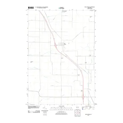
2010 Map of New Auburn
USGS Topo · Published 2010About this map
New Auburn serves as the central hub of this northern Chippewa County landscape, situated at a major crossroads where County Highway SS and Highway 53 intersect. The town's surrounding rural layout is defined by a dense network of numbered streets and avenues, reflecting the organized agricultural expansion of the region. Local history and genealogy are well-represented by a concentration of burial grounds, including New Auburn Cemetery, Duncan Creek Cemetery, Marquardt Cemetery, and Pleasant Valley Cemetery, which are scattered among the waterways that drain the area. Natural features like Old Maids Bluff and the New Auburn Wildlife Area offer a contrast to the geometric grid of farm roads. The drainage of the land is visible through the courses of Beaver Creek, Sand Creek, and Spring Brook, which eventually feed into the larger Duncan Creek and Trout Creek systems at the southern edge of the quadrangle.
Find a feature on this map
47 named features on this map. Tap any name to fly to it.
Don’t see what you’re looking for? This feature index may not catch every label — zoom into the map to look around manually.
Map Details
Editions of this 2010 New Auburn Map
This is the sole edition of this map. No revisions or reprints were ever made.
Other maps of this area

1948 · Weyerhauser
USGS Topo · 1:48,000

1949 · Bloomer
USGS Topo · 1:62,500

1949 · New Auburn
USGS Topo · 1:62,500

1950 · Weyerhauser
USGS Topo · 1:48,000

1951 · Bloomer
USGS Topo · 1:62,500

1951 · New Auburn
USGS Topo · 1:62,500

1951 · Chetek
USGS Topo · 1:62,500

1953 · Rice Lake
USGS Topo · 1:250,000

1959 · Rice Lake
USGS Topo · 1:250,000

1972 · Chain Lake
USGS Topo · 1:24,000