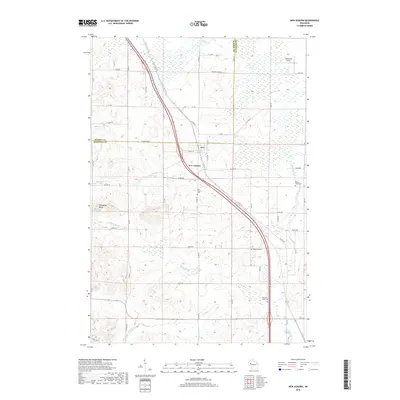
2018 Map of New Auburn
USGS Topo · Published 2018About this map
New Auburn serves as the central hub of this Wisconsin landscape, straddling the border between Barron Co and Chippewa Co. The village is a critical point along Co Hwy SS, where the local road network—including W Dell St and W Tarr Rd—radiates into the surrounding agricultural and wooded terrain. Significant genealogical markers are found in the four burial grounds scattered across the township, including New Auburn Cem and Duncan Creek Cem to the east.
Find a feature on this map
54 named features on this map. Tap any name to fly to it.
Don’t see what you’re looking for? This feature index may not catch every label — zoom into the map to look around manually.
Map Details
Editions of this 2018 New Auburn Map
This is the sole edition of this map. No revisions or reprints were ever made.
Other maps of this area

1948 · Weyerhauser
USGS Topo · 1:48,000

1949 · Bloomer
USGS Topo · 1:62,500

1949 · New Auburn
USGS Topo · 1:62,500

1950 · Weyerhauser
USGS Topo · 1:48,000

1951 · Bloomer
USGS Topo · 1:62,500

1951 · New Auburn
USGS Topo · 1:62,500

1951 · Chetek
USGS Topo · 1:62,500

1953 · Rice Lake
USGS Topo · 1:250,000

1959 · Rice Lake
USGS Topo · 1:250,000
1972 · Chain Lake
USGS Topo · 1:24,000