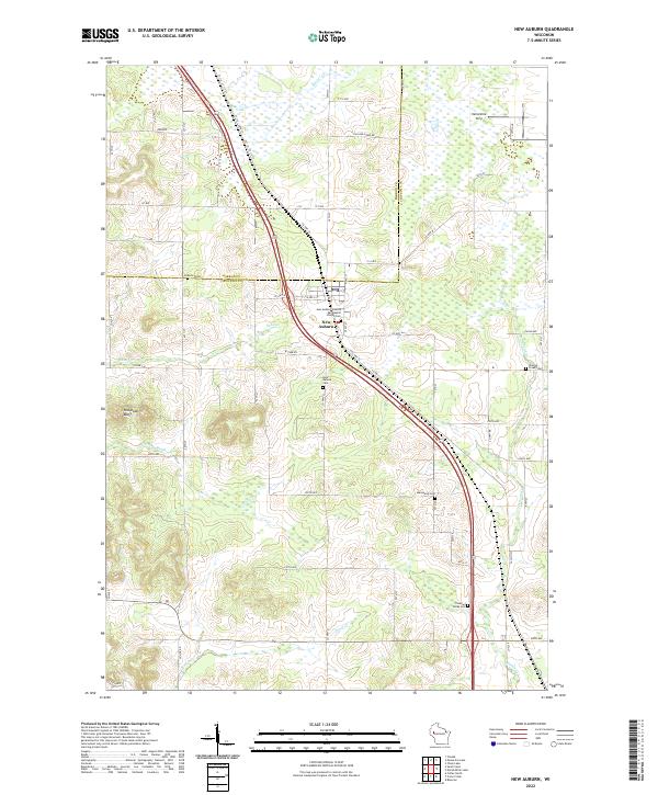
2022 Map of New Auburn
USGS Topo · Published 2022About this map
New Auburn serves as the primary hub of this landscape, situated at the junction where Barron Co, Chippewa Co, and Dunn County boundaries converge. The village is anchored by community landmarks such as the New Auburn Seventh Day Baptist Church and the New Auburn Cem. This modern survey reveals a region defined by agricultural plots and a network of named watercourses, including Sand Cr and Duncan Cr, which drain the undulating terrain. To the west, the distinctive elevation of Old Maids Bluff stands out against the grid of county roads. For those tracing local heritage, several smaller burial grounds like Marquardt Cem and Pleasant Valley Cem are noted, alongside the Vetterkind Strip airfield, reflecting the mix of traditional land use and small-scale aviation that characterizes this part of rural Wisconsin.
Find a feature on this map
61 named features on this map. Tap any name to fly to it.
Don’t see what you’re looking for? This feature index may not catch every label — zoom into the map to look around manually.
Map Details
Editions of this 2022 New Auburn Map
This is the sole edition of this map. No revisions or reprints were ever made.
Other maps of this area

1948 · Weyerhauser
USGS Topo · 1:48,000

1949 · Bloomer
USGS Topo · 1:62,500

1949 · New Auburn
USGS Topo · 1:62,500

1950 · Weyerhauser
USGS Topo · 1:48,000

1951 · Bloomer
USGS Topo · 1:62,500

1951 · New Auburn
USGS Topo · 1:62,500

1951 · Chetek
USGS Topo · 1:62,500

1953 · Rice Lake
USGS Topo · 1:250,000

1959 · Rice Lake
USGS Topo · 1:250,000
1972 · Chain Lake
USGS Topo · 1:24,000